click on the titles to find out more
Martin Pfennigbauer, Peter Rieger, Bernhard Groiss: How to make best use of RIEGL’s Ultimate LiDAR Technology in forestry
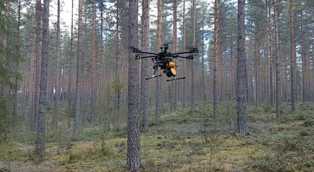
This is the keynote presentation by our STAR sponsor Riegl.
Juha Hyyppä: Recent developments with mobile laser scanning for forestry applications

The automation of forest field reference data collection has been an intensive research objective for laser scanning scientists ever since the invention of terrestrial laser scanning more than two decades ago. In this presentation, we will demonstrated several mobile laser scanning and UAV-based techniques that are able to provide accurate estimates of canopy height and stem volume for field reference in boreal forest conditions. We will report and compare performance of backpack, hand-held, under-canopy and above-canopy laser scanning for stem reference estimation. The accuracy of the obtained tree height estimates are equivalent to airborne above-canopy UAV surveys and field measurements. Stem volumes of individual trees has been obtained with a standard error at the level of 10% even exceeding field measurements. This level of error is equivalent to the error obtained when merging above-canopy UAV laser scanner data with terrestrial point cloud data. The results show that we do not necessarily need a combination of terrestrial point clouds and point clouds collected using above-canopy UAV systems in order to accurately estimate the heights and the volumes of individual trees in reference data collection. Systems, data processing methods, experiments, results and future vision will be presented.
Co-authors: Antero Kukko, Harri Kaartinen, Eric Hyyppä and Xiaowei Yu
Juha Hyyppä is professor of remote sensing and photogrammetry and director of FGI Remote Sensing. He was PI of Academy Finland Centre of Excellence in laser Scanning Research and is currently Vice-PI of Academy of Finland forestry-based flagship UNITE. He is interested in new laser scanning technologies, drone and mobile mapping, autonomous driving, and applying them into various applications. He has more than 260 Web of Science articles with an H-index of 57 in Core Collection.
Xinlian Liang: Benchmarking of close-range point clouds for forest observations — What are recorded and what are extracted

The lack of affordable and detailed field references is currently a bottleneck that is limiting the effective usage of abundant remote sensing data. Field references conventionally have been acquired using field measurements in a small scale at selected locations. The last decades witnessed a dramatic change in close-range remote-sensing-based forest field inventories, including the terrestrial- and UAV LiDAR and Imagery systems. The constant improvement in the sensors performance and the steady advances in the platform availability paved the way to turn the time-consuming manual forest field data collections into rapid autonomous observations. Reports on new advanced progresses and highly accurate estimations are constantly increasing, yet significant variance exists among the reported results, e.g., contradict conclusions can be found from existing studies. Credible interpretation of the existing results is in need, in order to distinguish the influences from the factors such as the forest conditions of test sites, the quality of data used, and the performance of algorithms. The key questions that need be clarified include, but not limit to, 1) the impact to the tree/forest attribute estimation from the data point of view, e.g., do systems and data acquisition approaches affect the performance of algorithms? 2) from the point of view of algorithm, to which extent can the recent algorithms reach at the best, e.g., can the automated algorithms perform similarly to manual processing? and 3) from the target point of view, the impact of different forest types/stand conditions on the quality of collected data and the results of processing, e.g., to which extent are the systems and algorithms applicable when dealing with different type of forests? In this talk, the state-of-the-art of these three questions will be clarified through a thorough review of several benchmarking studies on close-range point clouds for forest observations. The main factors affecting the accuracy of tree-centric estimates and possible solutions will also be discussed.
Dr. Xinlian Liang, professor at Wuhan University, received his doctoral degree from Aalto University (Finland) in 2013 with honor. His current research interests focus on innovative close-range remote sensing and geospatial solutions in capturing and modeling forest ecosystems and their services. He had coordinated a few international benchmarking researches, e.g., EuroSDR International benchmarking on TLS methods, ISPRS International benchmarking of terrestrial image-based point clouds for forestry, International benchmarking of the individual tree detection methods for modeling 3-D canopy structure, etc. He is the chair of the ISPRS Working Group ‘Thematic Information Extraction’, an IEEE senior member and the associate editor of the journal Forest Ecosystems.
Amy Neuenschwander: IceSat-2 for forestry applications
On September 15, 2018 NASA launched the ICESat-2 (Ice, Cloud, and land Elevation Satellite-2) laser altimeter from Vandenburg Air Force Base. Although the primary mission goal of ICESat-2 is to monitor changes in the cryosphere, ICESat-2 also collects elevation data over the Earth’s land surfaces providing geodetic measurements to support a wide range of terrestrial applications. In the temperate and tropical regions, ranging measurements from ICESat-2 are used to produce estimates of terrain and canopy heights of the worlds’ forests. The density and vertical distribution of the returned photons from within the canopy can be utilized to infer information regarding forest biomass, canopy volume, habitat mapping, biodiversity, and parameterization of land-climate models. The ICESat-2 satellite is in a polar orbit (92 degrees) and is the only space based laser altimeter capable of collecting ranging measurements over all land surfaces.
The instrument onboard ICESat-2 is the Advanced Topographic Laser Altimeter System (ATLAS) and ATLAS is sensitive to detect single photons reflected from the surface. ATLAS uses a 532 nm laser that fires at a rate of 10 kHz (or every 70 cm on the Earth’s surface) which facilitates high spatial resolution in the along-track direction. A diffractive optical element splits the ATLAS laser into 6 beams; 3 beam pairs approximately 3 km apart. Each beam pair is comprised of a strong beam and weak beam. Because ATLAS is sensitive at the photon level, solar background noise can present a challenge in the analysis or photon counting data. ICESat-2 is a profiling lidar and a result of the beam configuration is high resolution in the along-track direction; however gaps exist between beams. In the mid-latitudes, ICESat-2 operates in vegetation mode which consists of off-nadir pointing the satellite to a different ground track each 91-day repeat cycle. Thus, rather than repeating an orbit every 91 days, ICESat-2 will point to a different location on the Earth to improve the spatial sampling. Over a period of two years, this series of off-pointing maneuvers has reduced the distance between tracks at the equator from 29 km to approximately 2 km. As the mission continues through time with more off-pointing maneuvers, the distance between ground tracks will continue to decrease.
Dr. Amy Neuenschwander is affiliated with the Center for Space Research of the University of Texas at Austin.
Håkan Olsson: Nationwide ALS-forest products supported by NFIs – current status and future trends

Experiences from the ongoing production and further development of a second nationwide Swedish raster database with forest variables based on airborne laser scanning data trained with National Forest Inventory (NFI) plots will be presented. The currently predicted variables are growing stock volume, basal area, stem diameter, tree height and aboveground tree biomass. In addition, a map of wet areas in the landscape is also produced from the laser data trained with NFI plot data. Ongoing development includes the prediction of site index and tree species proportions. A long-term vision is to apply data assimilation where forecasting and new predictions are combined over time. The raster database is distributed as open data by the Swedish Forest Agency. Among the users are forest companies that use the data for updating their stand registers. The raster database is also used for pre-stratification of the temporary NFI plots. Experiences from the production and use of similar products in other countries will be presented as well. This part will build on answers from a questionnaire sent out to NFIs and other authorities that produce similar large area raster databases based on 3D remote sensing data and field reference data.
Co-Author: Mats Nilsson
Acknowledgements: The international contributors will be acknowledged in the final version of the speech.
The current national laser scanning of Sweden and follow on production of forest variables is co-financed by the Swedish government and several Swedish forest companies, under the leadership of the Swedish Forest Agency. Lantmäteriet (the National Land Survey) manage the acquisition of laser data that is carried out by Hexagon, and the Swedish University of Agricultural Sciences produces the raster databases with forest variables. Further development is done within the project Mistra Digital Forest. The map of wet areas in the Swedish forests is developed by Dr William Lidberg at the Swedish University of Agricultural Sciences.
Håkan Olsson became professor in forest remote sensing at the Swedish University of Agricultural Sciences in 1994. In addition to research and teaching, the university is also responsible for the Swedish National Forest Inventory. He has together with Dr Mats Nilsson, initiated several nationwide remote sensing products where sample plots from the NFI have been used as ground truth. Håkan Olsson became professor emeritus in July 2021 but is still active in the steering group for the second national laser scanning of Sweden and the associated production of a second nationwide forest database.
Mike Wulder: Air- and spaceborne lidar data as reference for satellite-based forest parameter retrieval and mapping over space and time

Combining infrequent and/or spatially limited lidar based measures of forest structural attributes with frequent and spatially exhaustive optical satellite imagery offers synergies for the mapping of forest attributes over large areas. Airborne lidar data has been demonstrated as a viable source of information relating forest structural attributes (such as height, canopy cover, biomass, and volume) to enable it’s use as reference data for the mapping of forest attributes over large areas in conjunction with optical satellite imagery and model informative spatial data layers. Given the high quality geolocation as well as the accuracy and diversity of forest structural attribution possible with airborne laser scanning systems (ALS), it is an ideal data source for model training and independent accuracy assessment. Purpose collected transects or opportunistically located wall-to-wall ALS data sets have been demonstrated as reference data options. There are a number of cases when ALS data may not be available with the desired traits, including spatial distribution over study region, capture of range of structural conditions present, etc. In such cases, spaceborne lidar datasets may provide new opportunities for systematic gathering of reference data. In this keynote, background on the use of lidar data as reference data will be shared, followed by example implementations representing large areas and long periods of time. Recent experiences in using spaceborne lidar data as reference data will then be offered, followed by sharing of issues and opportunities for further, and improved, use of this novel data capture opportunity.
Dr. Mike Wulder is a Senior Research Scientist with the Canadian Forest Service of Natural Resources Canada. He uses remotely sensed and spatial data to study and monitor forests across Canada, over a range of scales, contributing to national and international programs. Mike received his Ph.D. in 1998 from the University of Waterloo and has worked at the Canadian Forest Service, Pacific Forestry Centre, in Victoria, British Columbia since then. His research efforts cover a range of scales from the plot- to national scale, with data sources including LiDAR to a range of optical satellites, leading to novel and open access map products of Canada’s forest land cover, change, and structure. Dr. Wulder’s major research publications include the book Remote Sensing of Forest Environments: Concepts and Case Studies (2003) and Forest disturbance and spatial pattern: Remote sensing and GIS approaches (2006); with publication of over 380 articles in peer reviewed journals that have been cited >22,000 times (Scopus; >34,500 Scholar Google) with an h-index of 73 (Scopus; 92 Scholar Google). Dr. Wulder is an adjunct professor in the Department of Geography at the University of Victoria and the Department of Forest Resources Management of the University of British Columbia. Dr. Wulder is a key member of the USGS/NASA Landsat Science Team (since 2006) and played a lead role in initiating the SilviLaser series of international conferences focused on laser remote sensing of forest environments, and co-chaired the 2002 and 2012 editions.
@mikewulder
https://www.researchgate.net/profile/Michael-Wulder
Qinghua Guo: Developing multiple platform LiDAR systems for scaling forest parameters from plot levels to global levels

Lidar can penetrate vegetation and has been proven to be capable of deriving forest structural parameters with high accuracy. However, the relatively high cost of lidar hardware systems has been a major obstacle to their use in large-scale forest inventory applications. During the last decade, developments in the self-driving and photogrammetry industries have led to the emergence of a series of light-weighted and low-cost laser scanners, providing opportunities to address the abovementioned problem. In our studies, we developed a series of near-surface lidar systems by implementing these low-cost laser scanners, such as light-weighted terrestrial laser scanner, dual-head backpack lidar system, drone lidar system. These systems were tested in different forest ecosystems, and we found they had comparable performances with similar high-end lidar systems. To further improve the effectiveness and efficiency of our lidar systems in forest parameters extraction, we have developed a series of novel algorithms, such as terrestrial lidar data registration, multi-platform lidar system data fusion, point cloud filtering, and individual tree segmentation. Finally, we collected over 30TB of near-surface lidar data across different forest ecosystems to map the national-scale forest parameters in China. A machine learning approach was developed to scale up forest parameters (e.g., forest above ground biomass, tree height) from plot scale to national scale through the integration with lidar data, satellite imagery and in-situ measurements.
Qinghua Guo is currently a professor at Peking University. He received his B.S. and M.S. degrees from Peking University, and his Ph.D degree from the University of California Berkeley. His recent research interests lie in developing near-surface (e.g., backpack, UAV and mobile) Lidar systems to map vegetation attributes (e.g., tree height, LAI, AGB, vegetation type) from individual plant-scale to national and global-scales. He has published more than 120 SCI journal articles and one textbook..
Gottfried Mandlburger: The benefits of different LiDAR systems – Full waveform vs. single-photon LiDAR
Forestry is one of the main drivers of LiDAR sensor development. Full waveform systems recording the entire temporal record of the backscattered laser pulse enable higher target detection rates, which allows deriving structural vegetation parameters in addition to the canopy and ground surface. This especially applies to compact full waveform sensors integrated on Unmanned Aerial Vehicles, which allow the estimation of forest parameters like diameter at breast height, stem curves, or even a full 3D-reconstruction of the entire tree skeleton. Modern airborne scanners operated on manned platforms, in turn, often feature multiple laser wavelengths in either the visible or the infrared domain of the electromagnetic spectrum enabling the derivation of vegetation indices on a per-point basis. In contrast to that, single photon sensitive sensors (Geiger-mode LiDAR, Single Photon LiDAR) have emerged in the recent years. Such sensors typically operate from higher altitudes leading to increased aerial coverage performance at the price of lower accuracy and moderate penetration capability. However, recent studies have demonstrated that such sensors are suitable for deriving forest inventory attributes like top height, Lorey’s height, basal area, stem volume, and the like. The talk provides an overview of these competing technologies and discusses the pros and cons of either technique.
Dr. Gottfried Mandlburger studied geodesy at TU Wien, where he also obtained his Ph.D. in 2006. After finishing a 3-years research stay at the University of Stuttgart (2017-2019), he returned to TU Wien in 2020, where he is currently working as senior researcher and lecturer at the research division photogrammetry within the Department of Geodesy and Geoinformation. His main research areas are airborne topographic and bathymetric LiDAR from both manned and unmanned platforms, multimedia photogrammetry, bathymetry from multispectral images, DTM modelling, topographic data management, and scientific software development. He is closely working together with experts in the field of hydraulic engineering emphasising on flood and habitat modelling. Gottfried Mandlburger is chair of the working group hydrography/bathymetry of the German Association of Photogrammetry and Remote Sensing (DGPF) and coordinator of the scientific LiDAR software suite OPALS developed at TU Wien. He currently acts as a guest editor for PFG (Journal of Photogrammetry, Remote Sensing and Geoinformation Science) organizing a special issue entitled “Bathymetry from images, LiDAR, and Sonar”. He is an awardee of ISPRS (U.V. Helava Best Paper Award 2019) and ASPRS (John I. Davidson President’s Award 2019) for recent publications on bathymetry from active and passive photogrammetry.